 Joan J. Fornós Joan J. FornósMiocene carbonate cliffs in the Balearic Islands are the fundamental meeting point of karst and coves. |
||
Coves are complex littoral geoforms, worked upon by the convergence of numerous processes that interact in a variety of ways. Karst processes, driven by the dissolution of limestone and responsible for the formation of most coves, is one of the most prominent. |
||
|
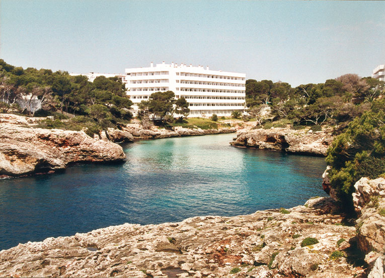
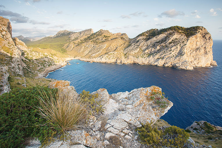
Coastlines undergo constant evolution and change as a result of the interaction between the solid medium, namely the land, the liquid medium, in other words the sea and fresh water, and the gaseous medium, that is the atmosphere. The dynamics affecting each of the three, along with the time variable, mean that the different processes occurring –or which have already taken place– are mirrored in coastal morphology. Coves are one of the most attractive coastal accidents. A cove is a complex landform resulting from the convergence of several key and highly variable factors that participate in its genesis. The first –most important and most basic– factor is the change in sea level, which is more or less uniform worldwide, caused by fluctuations in the ice in the continental and polar regions, or by changes in the capacity of marine and ocean basins. In cold periods, when the sea level drops because there are large accumulations of ice in inland areas, the base level that determines the rivers also drops and therefore the rivers tend to cut into the valleys to accommodate the new situation. Similarly, if there are holes or cavities that have formed inside geological formations, the loss of hydrostatic support when the water table drops can cause them to collapse. By contrast, in warm periods continental ice melts and water runs back to the ocean, then the corresponding rise in sea level floods the lower parts of river valleys, which in the long term –though not always– can fill up with sedimentary deposits that can be continental, transition or inland deposits. The second factor favouring the development of a river is the fluvial component. Although the processes linked to river flow in the Balearic Islands are barely visible nowadays, at some point they may have exerted a role in establishing a short –now relict– drainage network, which can be identified, but which never acquired the characteristics typical of an estuary. The tectonic structure is the third factor and exerts a basic influence on the lines of weakness, exploited by all erosion-based processes, which end up shaping the landscape. Weakness results in the breakdown of rocks, formation of fractures or faults, due to mechanical stresses occurring at the Earth’s crust (tectonic processes), and on having a directional component, its role will result in the linearity of the resulting forms. In coves, box canyons often intersect at various angles, showing a characteristic grid formation. Having discussed these aspects, we can say that coves have traditionally been associated with fluvial incision that occurred during the last glacial stage –finishing around 100,000 years ago–, which, with the subsequent rise in sea level, created an estuary environment surrounded by cliffs. Nevertheless, if we look closely, the morphological variability of coves would indicate that the linearity of the river courses and the coastline (conditioned by fracture) do not fully fit in with most coves’ layout nor that of many rivers; therefore, we have to postulate other processes that may have contributed to the development and evolution of these landforms. Accordingly, there is a new model to explain the evolution of coves, where karst-related processes take on an important role. |
||
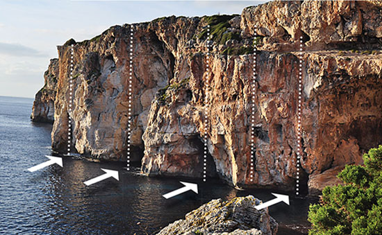 Joan J. Fornós Joan J. FornósKarstic groundwater ducts at the foot of the cliffs (arrows) related to the fracture (dotted lines) favour marine erosion. |
«Coves are one of the most attractive coastal accidents, a complex landform resulting from the convergence of several key factors in its genesis» |
|
|
Karst and rock influence The word karst comes from karra, which has a pre-Indo-European origin and means anything related to stone. Much of current western Slovenia and Trieste in Italy have a rocky landscape, sterile and without surface runoff, which bestows very specific characteristics. From the toponym of this region, in the late eighteenth century the term was Germanised and internationalised from a scientific viewpoint by the Viennese School of Geography and Geology. Thus the landscape features of the Karst (or Kras) region, served scientists to name karstic phenomena and, from then on, the word spread wherever this geomorphology was to be found, namely, the carbonate landscapes affected by the porosity and solubility of the rock. By karst, we understand a whole set of processes that result from these distinctive hydrological features and give rise to a landscape resulting from the combination of high rock solubility and well-developed secondary porosity (due to rock breakage). The fact there is high porosity (void space within the rock) implies that water seeps into the ground quickly, and thus surface runoff disappears. In turn, this infiltration increases potential water contact with the rock, which, on having high solubility, dissolves. Consequently, the rock is hollowed out and takes on very characteristic shapes. In turn, this further increases porosity (the hollows become larger) and we could say that the process feeds on itself. All rocks are soluble in varying degrees, but only a few are capable of feeding karst. These phenomena are all the more remarkable when other physical geomorphic processes, both hydrodynamic and aerodynamic (such as those affecting fluvial, glacial or aeolian modelling) are lower in intensity. Among the most soluble rocks, evaporites (salts and gypsum) and especially calcareous rocks provide the most spectacular examples. Sinkholes are quintessential karst forms generated in these rocks (a kind of closed funnel-shaped circular depression, known as foies in Valencia, comes in the Balearic Islands), caves (or underground cavities) and grooved forms (karren or lapiaz) observed in rocky outcrops. |
||
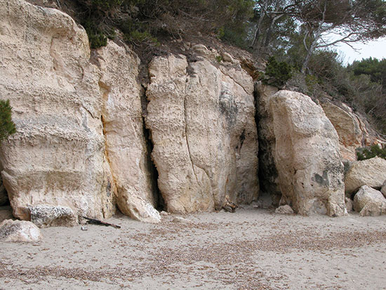 Joan J. Fornós Joan J. FornósThe fracture marks the weak points in the rock, which affect both the processes of dissolution by groundwater and the mechanical breakdown of the rock, leading to collapse and landslides. |
«Calcareous rocks are resistant to erosion, indicating that on the coast, cliffs are the most characteristic form» |
|
|
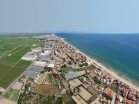
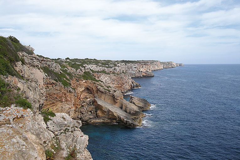
Any geomorphic process requires a substrate material, so the chemical properties and, above all, the texture of the rock affect the resulting forms. To this, we should add rock breakage, creating weak areas easily attacked by the physical processes of erosion, and ultimately this also determines the action of karst or dissolution processes, as they act on these planes which fracture, favouring water conduits. Thus, by exercising its task of dissolution, water widens fractures to form ducts and cavities, thereby weakening the overall structure of a geological formation. In the Balearic Islands, limestone rocks are everywhere. We are in a temperate climate zone where seasonal rainfall is more or less regular, so it is easy to imagine that karst is one of the most important processes affecting the moulding of the islands. Calcareous rocks might be considered hard, that is, they are resistant to erosion by physical processes. It would seem to follow, then, that cliffs are the most characteristic coastal form. The variability we find in these, results from geological aspects, including those of a tectonic or structural nature, mainly due to deformation and rupture processes undergone during geological epochs. Another factor concerns chemical processes. The greatest development undergone by coves in the Balearic Islands is mainly associated with carbonate materials from the Upper Miocene (from 11.6 to 5.3 million years). These deposits form rocky outcrops that are widespread in southern Menorca and in the south and east of Mallorca, forming what are called les marines. They correspond to a structural relief comprising a series of well stratified calcarenite and limestone formations on a horizontal tabular relief that, on reaching the coastline, are cut by vertical walls. These materials settled in a shallow marine shelf environment with the development of coral reefs and a much warmer climate than ours today. |
||
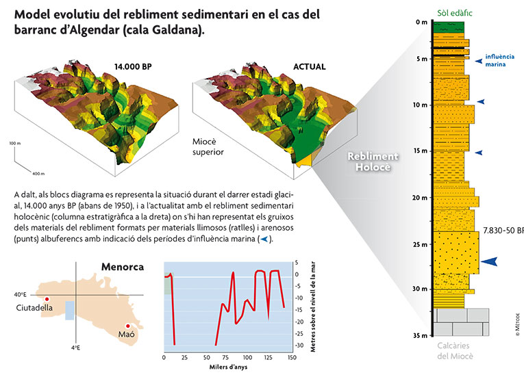 Mètode MètodeThe graph shows the sea level oscillation curve in the Balearic Islands, dating from the last interglacial stage, namely during the last 150,000 years. |
||
|
The role played by structure and fracture Materials dating from the Upper Miocene, as indicated by their structure, are post-orogenic, meaning that they have not undergone any major compressive deformation as affects older materials common in the Balearic Islands (caused by the collision between the African and Europe plates during the Alpine Orogeny), giving rise to the most important reliefs. These materials, however, are affected by tectonic relaxation produced after compression. The result is a set of fractures and joints (rupture without vertical movement) with highly consistent orientation, according to the stress field that caused them. Several intersecting directions can be discerned, making a kind of lattice on the surface. One of these directions coincides with the predominant coastal line and is responsible for cliff formation and erosion, assisted by marine dynamics. The other directions, at a more or less regular angle to the coastline, tend to create squared forms, which are noticeable along most of the coast. As already mentioned, water penetration is favoured by fractures and, therefore, it here that rock dissolution is concentrated. For the same reason, where fracture movement occurs, penetration and –thus– dissolution are increased. This becomes the most common place for the formation of potholes, ponors and closed depressions or sinkholes. Some paradigmatic examples of coves are to be found on the island of Menorca, where we can observe the various stages of development, from inception, as is the case of Cala Sant Llorenç, to the more developed stages of the well known Cala Galdana. In the first case, a steep ravine and short meandering stretch is surrounded by large cliffs, whose linearity depends on fracture directions, which have a sharp concave shape. These cavities show signs of recent gravitational dismantling with the marks of delapsional processes and block accumulation at the base. The observation of groundwater ducts, linked to the current sea level and opening out onto the seafront, which coincide with the points of structural weakness, can be related to the formation of sinkholes. These –along with underlying cavities– are reached by the sea, causing the wall to collapse, which is favoured by vertical cracks, resulting in concave forms and leading to a repetitive and coalescing retreat of the cliff. The fluvial process would be more likely to start its incision here. A fully developed case is Cala Galdana. This cove is linked to a perennial watercourse, presenting a clear river mouth, but one with a flat bottom due to sediment clogging from the last rise in sea level. The shape of the cove is typically circular, bounded by vertical cliffs showing continuous concave shapes, both in the final stretch of the gorge and upstream, where they are highlighted by the meandering course of the stream. The concave shapes coincide with points of structural weakness in the walls (vertical fractures), exploited by karst-like sinking. The collapse or subsidence is caused by sinkholes with vertical ducts, favoured by fracturing, and which are intersected by horizontal ones, situated at sea level. |
||
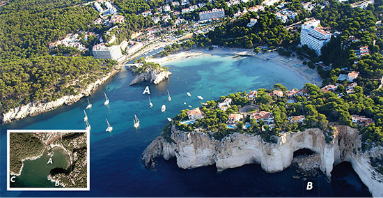 Mètode MètodeAerial view of Cala Galdana (Menorca) with associated karstic features. (A) fracture-dependent groundwater duct (B) sinkhole collapse related to groundwater ducts, (C) incidence of fracture in karst process localisation. |
||
|
How coves evolve We could say that a creek represents the total interaction between fluvial modelling, the geological structure, marine dynamics and karst processes. In the littoral zone, karst cavities abound. There are known to be a whole series of ducts and cavities, in different stages of development, following a path parallel to the coast, as well as channels running along the beds of watercourses and gorges. This situation is explained by the hydrological phenomenon that occurs in these situations, with the mixture of sea water penetrating inland due to porosity and rainwater infiltration feeding groundwater aquifers. The meeting of these waters having different chemical composition makes them more aggressive and leads to further corrosion of the limestone, causing the formation of large voids. Consequently, a string of cavities and ducts form around the point of contact between the seawater and the freshwater aquifer. The specific features and layout of this intrusion will obviously depend on groundwater and river flow and the degree of rock porosity. Meanwhile, karstic processes also relate to distension fractures which preferably channel the flow of water through the fracture-related discontinuities. This mechanism causes the cavities to branch out and promotes marine erosion as the sea tends to capture (or intercept) the cavities and ducts, leading to the onset of marine inputs (inlets) that could end up as coves. At this point we must take into account the variability in sea level during the Quaternary. Major development of cavities and ducts occurs at times of marine stabilisation, when dissolution would lead to the development of hollows associated with the corresponding sea level. Variation in sea level due to glacio-eustatic factors may explain the overlapping of dissolution layers at different levels, which would probably favour the formation of sinkholes and their subsequent collapse due to the loss of hydraulic support in times of falling sea levels (glacial or regressive periods). This is indicated by the final shape of coves, which are circular or elliptical and bordered by vertical walls, and a large portion of the route of ravines, especially in the last stretches. In short, falling sea levels would induce collapse and acceleration of the dismantling process of cavities and ducts, while periods of high sea level would cause the sea to invade the areas excavated during box canyon formation, as well as the tendency of these to become clogged by sediments. Detailed analysis of the Balearic Islands’ coves shows us that most of them have a lot to do with karstic ducts and cavities. It does not mean that the formation mechanism is uniquely and exclusively due to karst phenomena, but rather that the interaction of different processes, including fluvial processes, would give rise to a cove and an associated ravine. The great diversity observed in cove morphometry is the result of interplay with other factors, such as marine dynamics, geological structure, lithological variation of carbonate rocks and, finally, the trends in sea level during the Quaternary. Bibliography Joan J. Fornós. Professor and Researcher. Research group studying karst and coastal geomorphology. University of the Balearic Islands (Spain). |
||